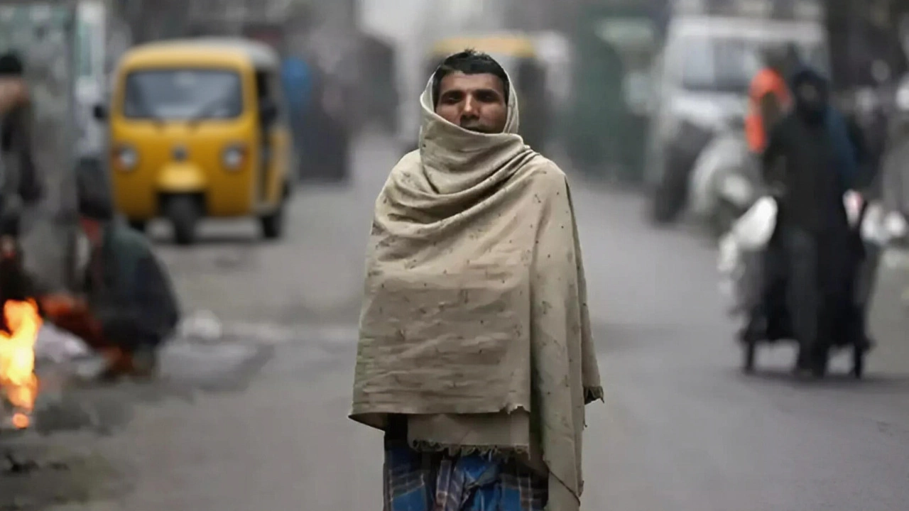
On October 13, 2025, a sudden and intense cold wave swept across North India, turning mornings into frosty affairs and sending shivers through cities from Delhi to the snow-capped peaks of Kashmir. The India Meteorological Department (IMD) issued its daily forecast with a warning: winter had arrived early — not with a bang, but with a biting chill that caught even seasoned residents off guard. In the Himalayan foothills, temperatures plunged to zero degrees Celsius, while Delhi’s minimum dipped to 18°C — nearly 5 degrees below seasonal norms. The twist? It’s only mid-October. This isn’t the usual seasonal shift. It’s a preview of what’s coming — and it’s unnerving.
North India Feels the Bite
From Himachal Pradesh to Uttarakhand, the mountains wore white. Snowfall blanketed high-altitude towns like Manali and Mussoorie, while valleys in Kumaon and Garhwal woke up to frost-laced grass. Locals in Pithoragarh reported ice forming on rooftops by 5 a.m. — a sight usually reserved for December. The India Meteorological Department (IMD) attributes this to a strong western disturbance, a weather system that typically arrives in November. This one came early, dragging cold air from the Caspian region down into the plains.
In Delhi, the contrast was stark. Daytime highs hovered near 30°C — warm enough for t-shirts — but by dusk, the temperature nosedived. The city’s average overnight low for this time of year is 22°C. Today, it was 18°C. Hospitals reported a 20% spike in respiratory cases among children and the elderly. "It’s not just cold," said Dr. Anjali Mehta, a pulmonologist at AIIMS. "It’s the dryness. The air feels like sandpaper. People aren’t prepared for this kind of shock after a dry, hot September."
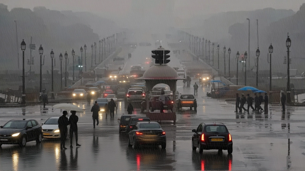
South and East: Rain, Not Frost
While the north froze, the east and south soaked. Odisha and West Bengal braced for heavy rainfall, with IMD issuing yellow alerts for coastal districts. In Cuttack, rain pounded streets for over six hours, flooding low-lying neighborhoods. Meanwhile, Maharashtra, Chhattisgarh, and Andhra Pradesh saw scattered showers — enough to dampen crops but not enough to break the drought. The monsoon, officially withdrawn in September, is now just a memory. What’s falling now is residual moisture from lingering cyclonic systems over the Bay of Bengal.
For the rest of North India — Uttar Pradesh, Bihar, and Uttarakhand — the IMD marked every district as "green zone": no rain, clear skies, but colder nights. Farmers in Kanpur and Patna are relieved — no more delays in harvesting kharif crops. But they’re also worried. "We planted wheat last week," said farmer Rajesh Singh from Bareilly. "If this cold keeps up, the seedlings won’t survive. We need warmth, not ice."
What’s Driving This Early Chill?
The science is clear: this is not a fluke. A strong western disturbance — a low-pressure system moving east from the Mediterranean and Central Asia — collided with a high-pressure ridge over Siberia. The result? A direct pipeline of Arctic air funneling into North India. This pattern is becoming more common. Climate models from the India Meteorological Department (IMD) show that since 2018, North India has experienced three early cold waves in October — compared to just one between 2000 and 2010.
"We’re seeing a shift in jet stream behavior," explained Dr. Rajiv Mehta, a climatologist at the Indian Institute of Tropical Meteorology. "The polar vortex is weakening, but when it dips, it dips harder. This isn’t just a cold snap. It’s a signal. The climate is becoming more erratic."
What the Numbers Say
The data paints a vivid picture:
- Delhi: Max 30°C, Min 18°C
- Jaipur: Max 30°C, Min 20°C
- Lucknow: Max 31°C, Min 20°C
- Patna: Max 31°C, Min 21°C
- Mumbai: Max 31°C, Min 26°C
- Kolkata: Max 32°C, Min 25°C
- Chennai: Max 31°C, Min 26°C
- Ahmedabad: Max 33°C, Min 21°C
For October 2025, IMD estimates total rainfall across India at 106 mm — just 4 rainy days in a month that usually sees 8. Meanwhile, sunshine hours average 11.6 per day. The cold wave has effectively erased the monsoon’s lingering humidity, leaving behind crisp, dry air — and a population unprepared for winter’s early arrival.

What’s Next?
IMD forecasts a continuation of the cold trend through October 20. Nights in the northern plains may dip below 15°C. Snowfall could extend to lower elevations in Jammu and Kashmir by October 18. Meanwhile, the southern states will see a gradual decline in rainfall by the end of the week. For now, the advice is simple: layer up. Keep heaters ready. And don’t assume winter won’t come until December — it already has.
Frequently Asked Questions
Why is it so cold in North India in October when it’s usually warm?
This is due to an unusually strong western disturbance, a weather system that typically arrives in November. This year, it moved faster and carried colder air from Central Asia, causing temperatures to drop 5–8°C below normal. Early snowfall in the Himalayas and dry, clear skies over the plains are accelerating nighttime cooling.
Are the early cold waves linked to climate change?
Yes. While individual cold snaps aren’t proof of climate change, their increasing frequency is. Studies show that as the Arctic warms faster than the rest of the planet, it destabilizes the polar vortex, leading to more extreme dips in cold air. India has seen three such early cold waves since 2018 — a trend not seen in previous decades.
Which areas are still expecting rain?
Odisha and West Bengal are under yellow alerts for heavy rain through October 15, with isolated downpours possible in coastal districts. Parts of Maharashtra, Chhattisgarh, and Andhra Pradesh may see light showers, but most of North and Central India remain dry. The monsoon has fully withdrawn.
How are farmers affected by this sudden cold?
Farmers who planted winter crops like wheat and mustard in early October are now at risk. Frost can kill young seedlings, especially in Uttar Pradesh and Bihar. Some have started covering fields with plastic sheets, but many lack resources. The IMD has advised delaying sowing until temperatures stabilize — which may not happen until late October.
Is this weather pattern likely to continue into November?
IMD predicts above-normal winter temperatures for November in most regions, but the early chill has reset the baseline. Even if it warms up, the gap between day and night temperatures will remain wide — making it feel colder than it is. The real test comes in December, when the full force of winter usually hits.
What precautions should people take?
Dress in layers, especially in the early morning and evening. Keep children and elderly indoors during peak chill hours. Use humidifiers indoors to combat dry air. Stay hydrated — cold, dry air dehydrates you faster than you realize. And don’t ignore early signs of respiratory distress — seek medical help if coughing or breathing becomes difficult.