Record Rainfall News and How It Affects You
Heavy rain can turn a normal day into a chaotic one in minutes. When the amount of rain breaks past what officials have ever recorded, it’s called a record rainfall event. Those numbers matter because they signal flood risk, strain on infrastructure, and often point to bigger climate patterns.
Every time a city reports a new rain total, the local meteorological department updates its database and issues alerts. You can see those alerts on weather apps, government websites, or even on your phone’s emergency notifications. The data isn’t just for scientists – it tells you when you might need to avoid driving, protect valuable items, or move pets to higher ground.
Why Record Rainfall Happens
Record rain isn’t random. It usually follows a mix of factors: a strong low‑pressure system, warm sea‑surface temperatures, and sometimes a stalled front that keeps clouds over the same area for days. In many places, these conditions are becoming more common as the planet warms. Warmer air holds more moisture, which means storms can dump more water when they finally release it.
Local geography also plays a role. Mountains force moist air upward, making it cool and drop its water load quickly. Urban areas with lots of concrete can’t absorb water, so runoff spikes and floods happen faster. When you hear about a historic rain amount, think about these ingredients working together, not just a lucky storm.
What to Do When Rain Breaks Records
First, stay informed. Sign up for regional weather alerts and keep an eye on reputable sources like the India Meteorological Department or your state’s disaster management agency. If an alert says the rain is expected to exceed past records, start planning early.
Second, protect your home. Move valuables off the floor, place sandbags at vulnerable doorways, and make sure your drainage pipes are clear. Even a small blockage can turn a few centimeters of water into a dangerous surge.
Third, think about travel. Flooded roads are a hidden danger – water can hide potholes, wash out bridges, or pull a car under. If you must drive, go slowly, avoid standing water, and let someone know your route.
Fourth, look out for neighbors, especially the elderly or those with limited mobility. A quick check‑in can save lives when emergency crews are stretched thin.
Finally, use the event to learn. After the rain stops, many local agencies publish post‑storm reports that show exactly how much rain fell, where flooding occurred, and what caused the most damage. Those reports help cities improve drainage, update building codes, and plan better for the next extreme event.
Record rainfall is a warning sign, not a headline you can ignore. By watching the numbers, preparing your home, and staying connected with your community, you can turn a potentially dangerous situation into a manageable one. Keep an eye on the forecasts, act quickly when alerts arrive, and remember that even small steps can make a big difference when the sky decides to break its own records.
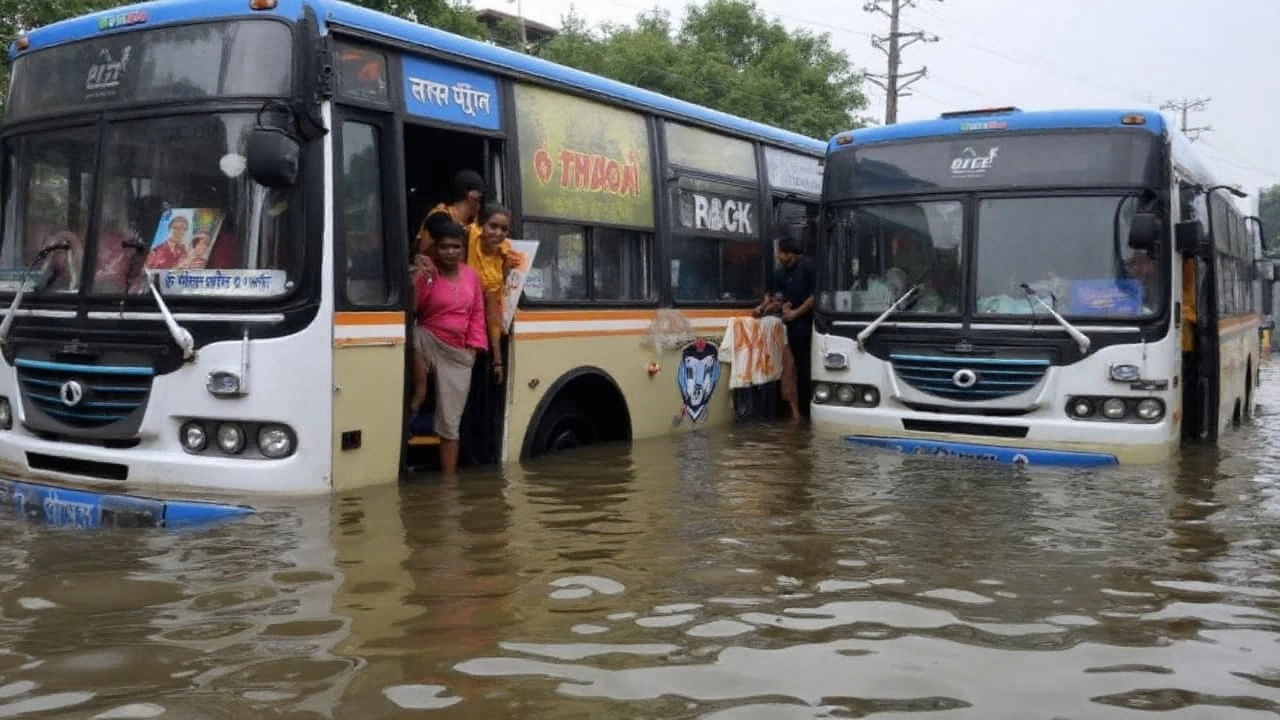
Kolkata Flooding 2025: Six Hours of Record Rain Submerged India's Cultural Capital
On September 23, 2025, Kolkata was hit by an unprecedented downpour that flooded streets, schools and transport hubs in a matter of hours. The deluge, coinciding with the start of Durga Puja, claimed 8‑12 lives and left dozens injured or missing. Rainfall totals topped 330 mm in some neighborhoods, overwhelming the city’s drainage. Closed lock gates compounded the problem, stopping natural outflow to the Hooghly River. The disaster has sparked fresh debate on climate resilience and urban planning in Indian metros.